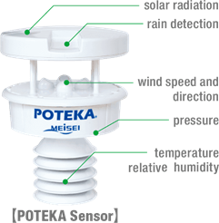
POTEKA Weather Observation and Information Service
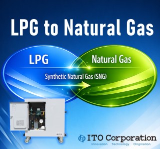
Producing natural gas from LPG Synthetic Natural Gas Generator "PA System"
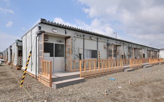
Provision of emergency temporary housing
Realizing digital transformation (DX) in disaster management
RiverCast
RoboQS
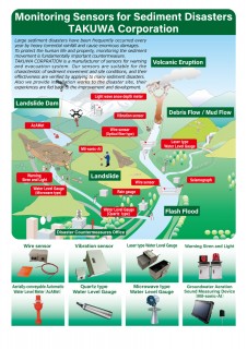
Sediment monitoring sensor/system for debris flow and landslide
Stimulating the industry of disaster and climate resilience technologies
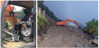
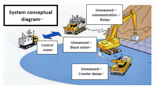
Tele-Erection System
Water Vision - High-resolution Flood Forecast solution
.png)
.png)