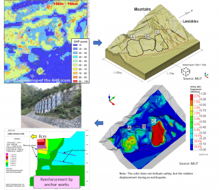
Prediction technology for slope behavior during earthquakes using numerical analysis
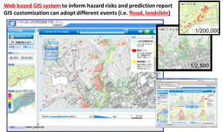
Real-time hazard information delivery system
Realizing digital transformation (DX) in disaster management
River Information System
RiverCast
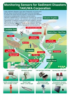
Sediment monitoring sensor/system for debris flow and landslide
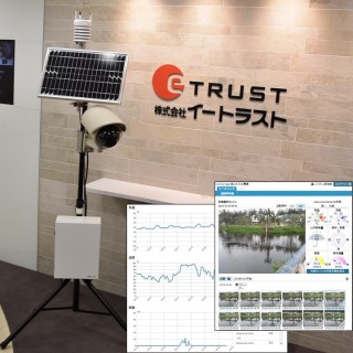
Sensor network and cloud technology based remote monitoring system
Slope Failure Monitoring "KANTARO"
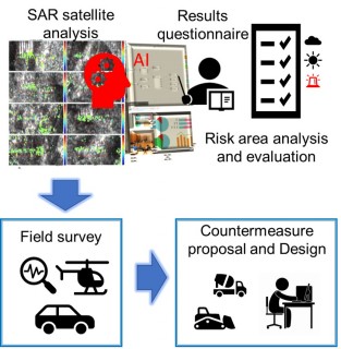
Slope movement monitoring service by use of SAR satellite
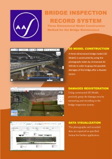
Three Dimensional Model Construction Method for the Bridge Maintenance
Total Road Risk Management Support Service
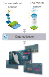
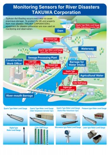
Water Monitoring Sensors for Preventing
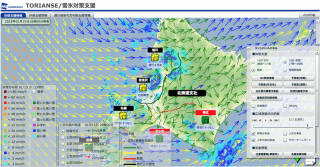
Water Vision - High-resolution Flood Forecast solution
.png)