Bosai Solution ID : JBP00092
POTEKA Weather Observation and Information Service
Real-time weather observation catches the signs of weather changes and changes the weather disaster prevention in your area.
Hazard
Solution Purpose
Solution Theme
Risk Assessment
Disaster Prevention Plan
Infrastructure Technology
Building Technology
Information & Communication Technology
Rescue & Medical Treatment
Products & Goods
Education & Training
Technology Subject
Risk Monitoring
Plan for Relief & Recovery Support
River & Basin
Dam & Reservoir
Coast
Sabo
Road
Railways
Airport
Port
Essential Utilities
Urban
Emergency Base & Back-up Facility
Information Gathering
Information Analysis & Judgement
Information Communication
Information Platform
Emergency Rescue Operation
Machinery & Equipment
Educational Publication
Advantages
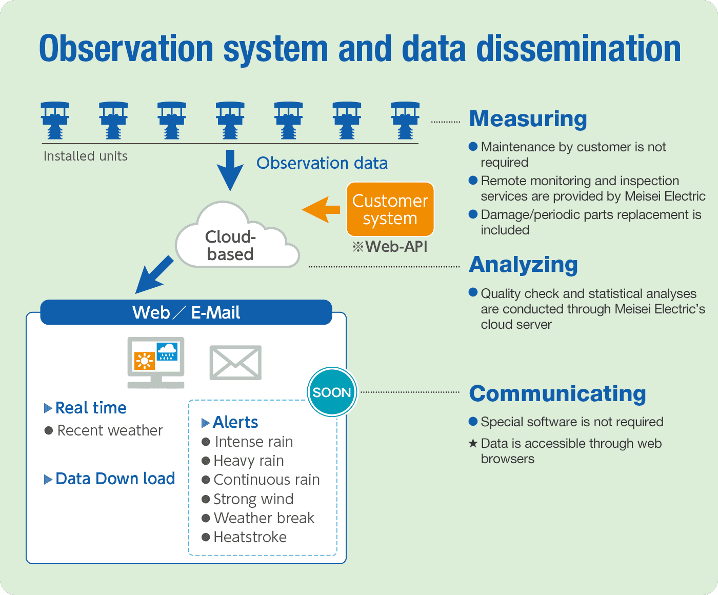
POTEKA collects information from small weather meters certified by the Japan Meteorological Agency on a global cloud server and provides it via the Web. If meteorological gauges are installed in a detailed area (target 2km mesh), accurate weather information can be pinpointed. In principle, real-time weather information is made public and can be shared with anyone via the Web, making it possible to make independent decisions. The basic items are temperature, barometric pressure, relative humidity, wind direction and speed, solar radiation, rainfall, etc. Various sensors such as water level, snow depth, cameras, etc. can be added as options.
Solution Illustrated
Background
POTEKA is a small meteorological instrument certified by the Japan Meteorological Agency (JMA), which enables information disclosure. The most important feature of this service is that it is free of the burden of the JMA certification fee.
The most significant feature of the service is that the real-time information from the JMA-certified small meteorological instruments is available on the Web as open data that can be shared with anyone in the world.
This enables us to obtain pinpoint observation data that cannot be supplemented by domestic AMeDAS, and to improve forecast accuracy and alert nearby stations of approaching extreme weather.
Real-time pinpoint information from POTEKA.net will be useful for making decisions on voluntary evacuation before a critical situation arises.
In Japan, about 1,000 units of POTEKA.net have already been installed by local governments and private companies, but the accuracy and range of use will be improved by further dense observation.
The optional water level sensor, called a crisis management type water level sensor in Japan, is a long-life, low-cost water level sensor that can be selected from three types: ultrasonic, radio wave, and hydraulic.
For more information on water level gauges, see the link below.
https://www.meisei.co.jp/english/products/hydrology/hydrology_sub/p2628
Exposition of the Solution
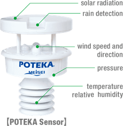
【Observation items】 Equipped with a rain gauge and seven weather sensors
The following eight elements of meteorological data can be measured: air temperature*, air pressure*, relative humidity*, wind direction and speed*, solar radiation, rainfall*. (*: with JMA certification)
【Optional sensors】
Various sensors such as water level meter, camera, snow, PM2.5, CO2, radiation, etc. can be installed.
【Installation】
With a 1m x 1m south-facing open space for the solar panels, and access to a cell phone, it only takes an hour to assemble. You can start observing right away.
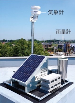
.jpg)
Example of rooftop installation Example of pole installation
【Method of providing data】
POTEKA's weather information is provided via POTEKA.net, which can be accessed by anyone with a PC or smartphone on the Web, and can also be provided via WebAPI to import data into your existing system.
【Applications for disaster prevention】
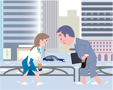
Measures against flooding and inundation
There are many areas that suffer from flooding and inundation due to weather changes such as localized heavy rains and storm surges caused by sudden changes in atmospheric pressure. By installing POTEKA in areas that are prone to flooding and inundation due to topography, it is necessary to properly monitor actual rainfall conditions and prepare for disasters.
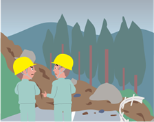
To prevent landslides
Landslides and other disasters are caused by localized heavy rainfall, but sudden heavy rainfall is difficult to predict. POTEKA uses an ultra-dense observation network to monitor the location and amount of rainfall in detail. The POTEKA system uses an ultra-high-density observation network to monitor the location and amount of rainfall in detail, enabling an accurate understanding of the situation in and around hazardous areas and prompt response. It is also possible to determine the possibility of river flooding based on actual measurements.

To prevent heat stroke
POTEKA calculates the "heat index" from the observed temperature and humidity. Also, since the "heat index" changes even at a distance of about 2 km, POTEKA's detailed observation network is useful. It is possible to alert people to heat stroke in units such as schools and communities where the system is installed.
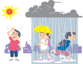
For unexpectedly strong rain
POTEKA is a real-time observation system, and it is easy to see where a large amount of rain is falling.
Based on the meteorological database accumulated by the meticulous observation network, POTEKA can detect the direction of rainfall in real time, and inform you of the occurrence of localized heavy rainfall.
The system can also be used by schools to decide when to dismiss students in groups to avoid guerrilla rains for their safety.
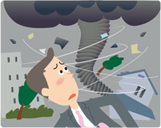
To protect against wind gusts
In order to protect our daily lives from wind gusts and tornadoes, which are said to be on the increase in recent years, it is important to catch the signs as soon as possible, and POTEKA captures sudden weather changes at observation points, increasing the possibility of detecting weather changes as a sign before a wind gust occurs.
Achievements of Examples
http://www.potekanet.com/
Introduction to POTEKA.NET
Select 〔EN〕/〔JP〕
Introduction to POTEKA.NET
Select 〔EN〕/〔JP〕
No special software is required, and the observation data can be freely viewed by anyone via the Internet.
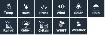
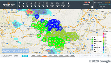 Meteorological data collected from the installed meteorological meters can be viewed on the "POTEKA NET" website. You can access it anytime, anywhere from your PC or smartphone. You can grasp the weather conditions of the place you want to know in real time. You can also select from 11 weather data patterns and display them on a map.
Distribution maps and rain cloud radar can also be displayed on the map.
POTEKA NET can display real-time weather information of observation points on a map in various formats. It is also possible to display rainfall and temperature distribution maps and rain cloud radar, which can be used in various ways by comparing them with the conditions at the observation point. Historical data can also be displayed and viewed.
For subscribers only
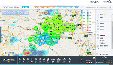
Data can be displayed in graphs and tables, and can be used for data analysis in times of disaster.
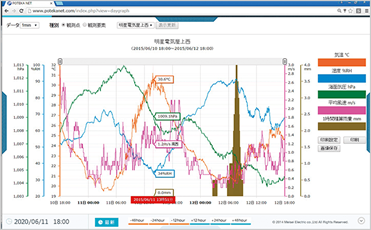 POTEKA NET has a database of various observed meteorological data, which can be displayed in graphs and tables.
The data can be displayed, browsed, or output in a variety of units such as days, months, and years.
The output format supports CSV and PDF download. It can be used for data analysis in times of disaster or as a countermeasure for future disasters. It can also be used for business purposes, research materials, and educational materials.
Other References

Corporate Profile
Meisei Electric Co., Ltd.
PMO Ichigaya 3F 2-19 rokubancho, Chiyoda-ku, Tokyo, 102-0085, Japan
Tel. : +81 3 6698 7797
E-mail : product_engmeisei.co.jp
Website : http://www.meisei.co.jp/english/