Bosai Solution ID : JBP00091

Slope movement monitoring service by use of SAR satellite
Wide-range slope movement monitoring by image analysis of synthetic aperture radar (SAR) satellite, and a one-stop service from desk analysis to countermeasure design
Hazard
Solution Purpose
Solution Theme
Technology Subject
Advantages
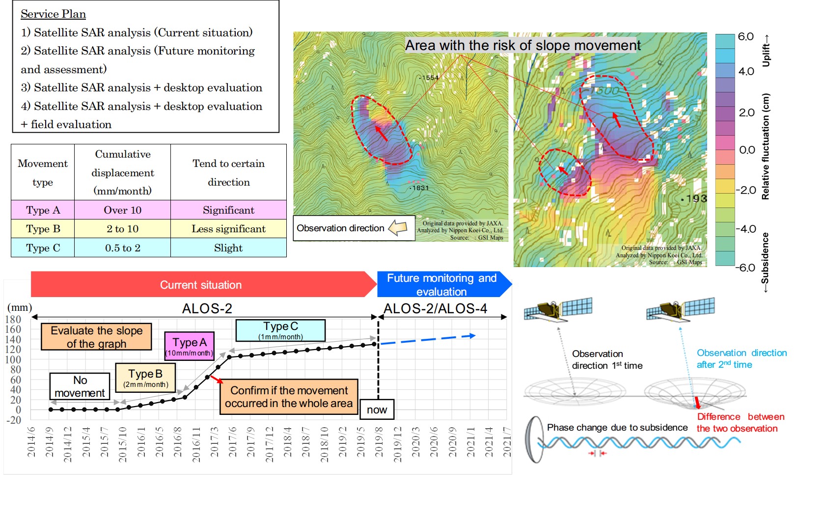
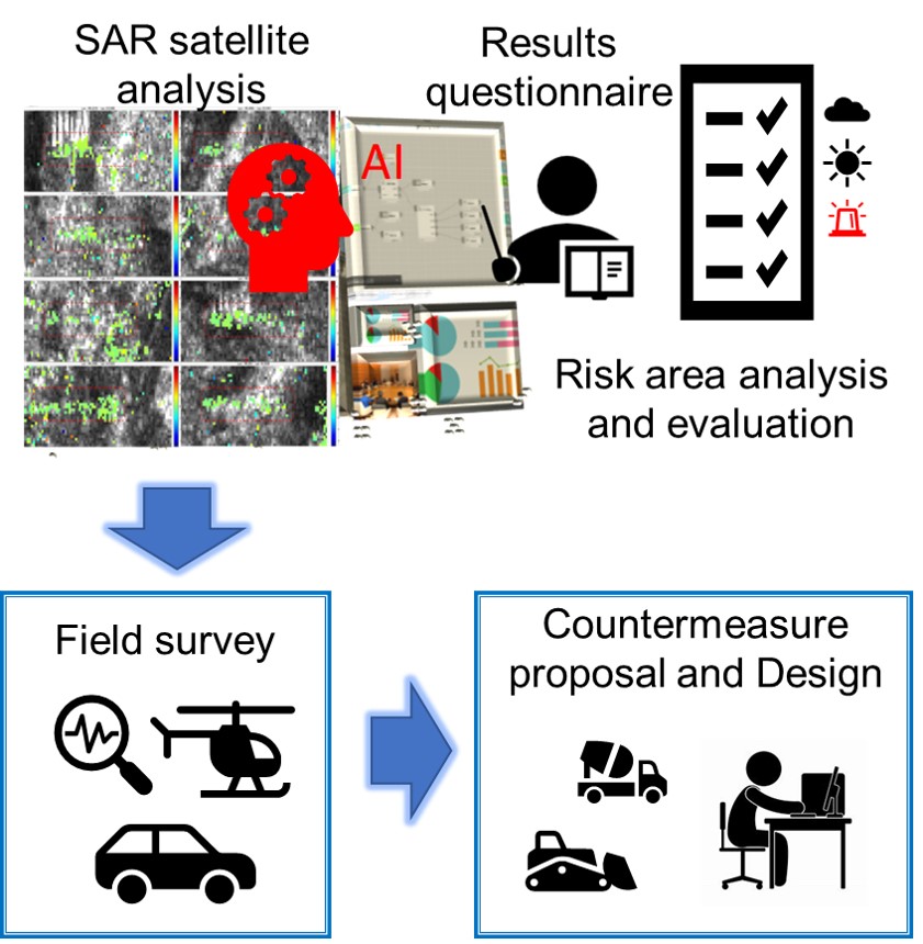
Two plans “Evaluation up to now (Risky slope identification)” and “Future monitoring and evaluation” are prepared and can be selected. By use of the archived images of SAR satellite, it is possible to confirm a wide range of previous slope movement. Quantitative risk evaluation (Type A to C) can be confirmed according to the landslide evaluation criteria by MLIT. Besides, as an optional service, a series of services related to slope countermeasures including desk analysis, field survey, countermeasures plan, and design can be provided.
Solution Illustrated

Background
In recent years, due to torrential rain caused by climate change, sediment disaster has become intensified apparently. In order to prevent and mitigate the damage caused by sediment disasters, it is important to quickly grasp the damage situation over a wide area. It is effective as a preventive measure to grasp small slope movement which could be a sign of landslides. However, it is impractical to monitor the movement with installed equipment on all slopes where there may be a risk of sediment disasters.
By using the SAR satellite, it is possible to grasp changes in the ground surface at the level of several centimeters over a wide area without installing measuring equipment on site. The monitoring method using the SAR satellite is now getting more and more attention as a land conservation technology because of its good balance between the economy and accuracy.
By using the SAR satellite, it is possible to grasp changes in the ground surface at the level of several centimeters over a wide area without installing measuring equipment on site. The monitoring method using the SAR satellite is now getting more and more attention as a land conservation technology because of its good balance between the economy and accuracy.
Exposition of the Solution
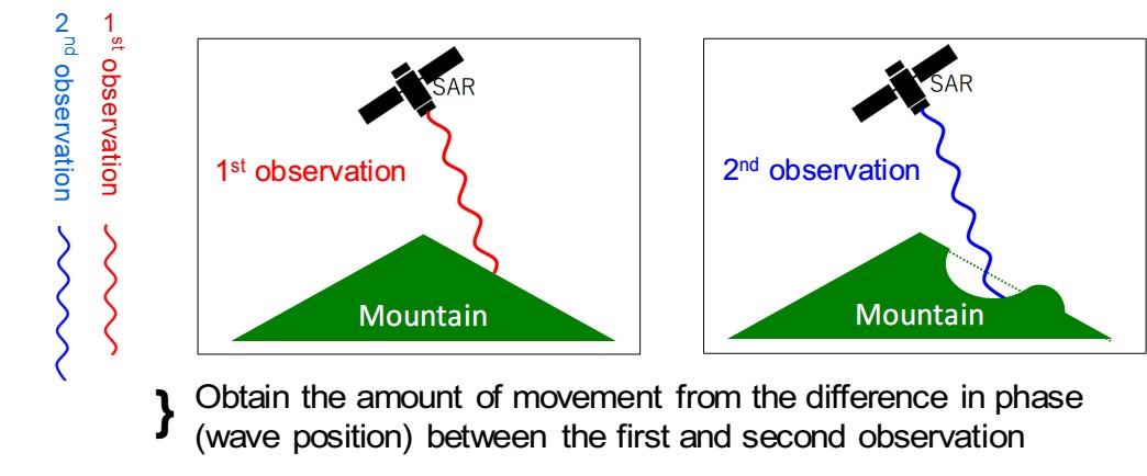
Interference SAR analysis is a method of analyzing displacement by interfering with the reflection intensity of a two-period single-polarized SAR intensity image to calculate the phase difference. It is possible to grasp the amount of surface displacement of the ground surface between different periods.


Achievements of Examples
It has been put to the practical use in movement analysis of road slope.
Corporate Profile
Nippon Koei Co., Ltd.
5-4 Kojimachi, Chiyoda-ku, Tokyo 102-8539, JAPAN
Tel. : +81-3-5276-3596
E-mail : int.agx.n-koei.co.jp
Website : http://www.n-koei.co.jp/english


