Bosai Solution ID : JBP00015

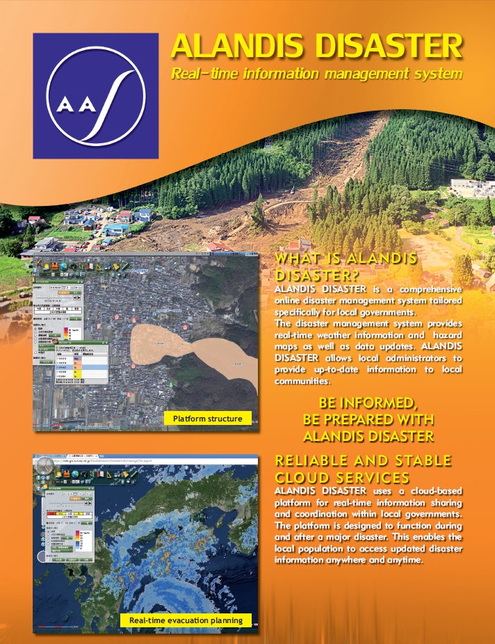
ALANDIS DISASTER
Real-time information management system
Hazard
Solution Purpose
Solution Theme
Research & Investigation
Risk Assessment
Disaster Prevention Plan
Infrastructure Technology
Information & Communication Technology
Education & Training
Evaluation
Technology Subject
Advantages
ALANDIS DISASTER is a GIS based disaster information system for collect information quickly and accurately when disasters occur.
The characteristics of the system are:
1.Support collecting and management for information that necessary for disaster treatment
2.Support decision making when disaster occur
3.Visualization and support action plan
The characteristics of the system are:
1.Support collecting and management for information that necessary for disaster treatment
2.Support decision making when disaster occur
3.Visualization and support action plan
Solution Illustrated
Background
Government offices and local governments, which are in charge of disaster response, have to provide accurate and immediate information when disasters occur. However, once disasters occur, the situation changes moment to moment so that it takes time to understand the various information and take appropriate measures. To solve this problem, AAS has developed Real-time information management system, ALANDIS DISASTER, which enables government offices and local governments to provide up-to-date information and support their decision making.
Exposition of the Solution
1. A system for support efficient information collecting for appropriate initial response while disasters occur and quick decision making.
2. Main functions and effectiveness:
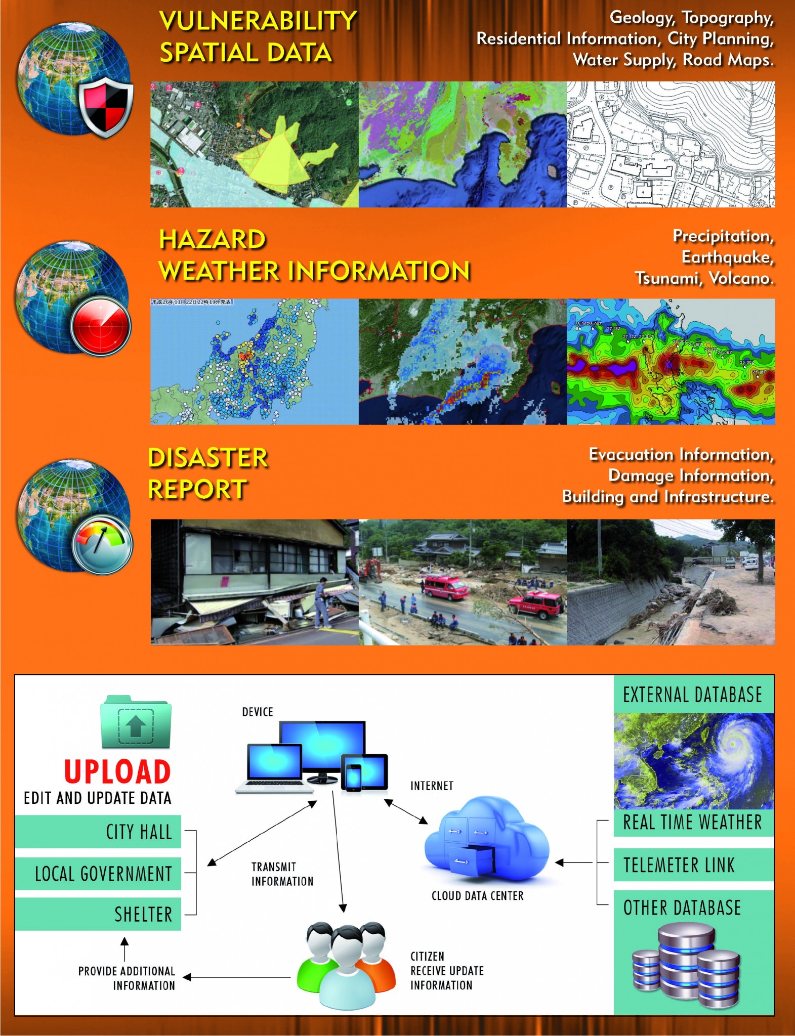
1) Information collecting: Collect information for disaster response, sophisticate, standardize and then labor save for management. The staffs can concentrate on disaster treatment by manage the real-time weather information, local hazard maps, disaster reports into GIS.
2) Decision making support: Support decision making by display the collected information on GIS and graphs. Appropriate judgments and decisions will be needed since the situation may change quickly during disasters occur. The system simply displays information that necessary for decision making.
3) Visualization and support action plan: By summarize and visualize the collected information, treated contents, site situation, the whole situation of disaster can be overlooked. Moreover, the system supports disaster treatment according to disaster prevention and mitigation action plan.
3.Unified management by collect and summarize related information such as weather information, hazard maps, disaster reports to GIS
4.Provided by clouds services
2. Main functions and effectiveness:
1) Information collecting: Collect information for disaster response, sophisticate, standardize and then labor save for management. The staffs can concentrate on disaster treatment by manage the real-time weather information, local hazard maps, disaster reports into GIS.
2) Decision making support: Support decision making by display the collected information on GIS and graphs. Appropriate judgments and decisions will be needed since the situation may change quickly during disasters occur. The system simply displays information that necessary for decision making.
3) Visualization and support action plan: By summarize and visualize the collected information, treated contents, site situation, the whole situation of disaster can be overlooked. Moreover, the system supports disaster treatment according to disaster prevention and mitigation action plan.
3.Unified management by collect and summarize related information such as weather information, hazard maps, disaster reports to GIS
4.Provided by clouds services
Achievements of Examples
1. Disaster information sharing inside municipality
2. Support decision making link with weather observation such like telemeter
2. Support decision making link with weather observation such like telemeter
Other References
ALANDIS DISASTER INFORMATION leaflet (Japanese)
Corporate Profile
Asia Air Survey Co., Ltd
Shinyuri 21 Building 3F, 1-2-2 Manpukuji, Asao-ku, Kawasaki-shi, Kanagawa Prefecture 215-0004, Japan
Tel. : +81-44-969-7510
E-mail : serviceajiko.co.jp
Website : http://www.ajiko.co.jp/en/